The big picture

Cool strips I’d like to visit <-Click here

Someone asked if I could post a larger view of my backcountry strip map.  Here you go.  I know the map on the my blog is a little small.  The pins with dots are the strips I’ve actually landed at.  Please note, the fact that I have landed there does not mean they are open to the public.  Some are, some aren’t.  Please check with property owners before landing on any one’s private property.

Monterey Bay Academy

Monterey Bay Academy is a strip I’d been planning on visiting for years but I kept getting conflicting info about it.  On New Year’s Day I finally just decided to show up and found out that it is indeed open to everyone.  They would prefer it not be used on Saturdays but they won’t get mad if you do land there on a Saturday.  They have a small donation bucket at the strip.  The strip sits up on a bluff that overlooks several miles of pristine sandy beach.  Here are a few pictures from my visit.

The runway and parking area are surrounded by flowers.

The view from the parking area.

No one around but me.

The runway

Sometimes a road is a runway

A few weeks ago I flew down to visit a friend and a friend of a friend.  Nice thing is the friend of a friend has a landing strip on his property.  It’s cleverly disguised as a dirt road to discourage garden variety pilots from trying to land there.  Not that I’m anything special but I’m just good enough not to roll my airplane up in a ball when landing off airport.  Not much else to report from the visit other than it was fun meeting my friend’s friends.

Image

Image

GoPro Hero3 Camera

I just purchased a GoPro Hero3 camera recently.  I’ve played with taking a few videos but haven’t really done much with it yet.  I also got a neutral density filter to try to get rid of the jelly prop effect.  I’m hoping the weather will be good enough tomorrow to try it out.  Here is a movie I shot with a borrowed GoPro camera: http://www.youtube.com/watch?v=1nDVTVohu00

Mercey Hot Springs

Took a ride down to Mercey Hot Springs today.  It’s located in the valley just below and to the west of the Panoche VOR (PXN).  They have a year round heated pool and many soak tubs.  It’s about 1 hour flight time from Oakdale (O27).  There is an 1800 foot dirt runway on the east side of the hot springs complex.  It is X’d off but pilots are welcome to land there.  The X’s are to pacify the county.   I was happy to find out that the owner didn’t even hear me come in and land.  It’s a very peaceful area and I like to do my part to keep it that way.  I spent about 2 hours soaking in the aromatic geothermally heated water.  Listened to the birds and the breeze in the trees.


My First Trip to Johnson Creek–Part 4

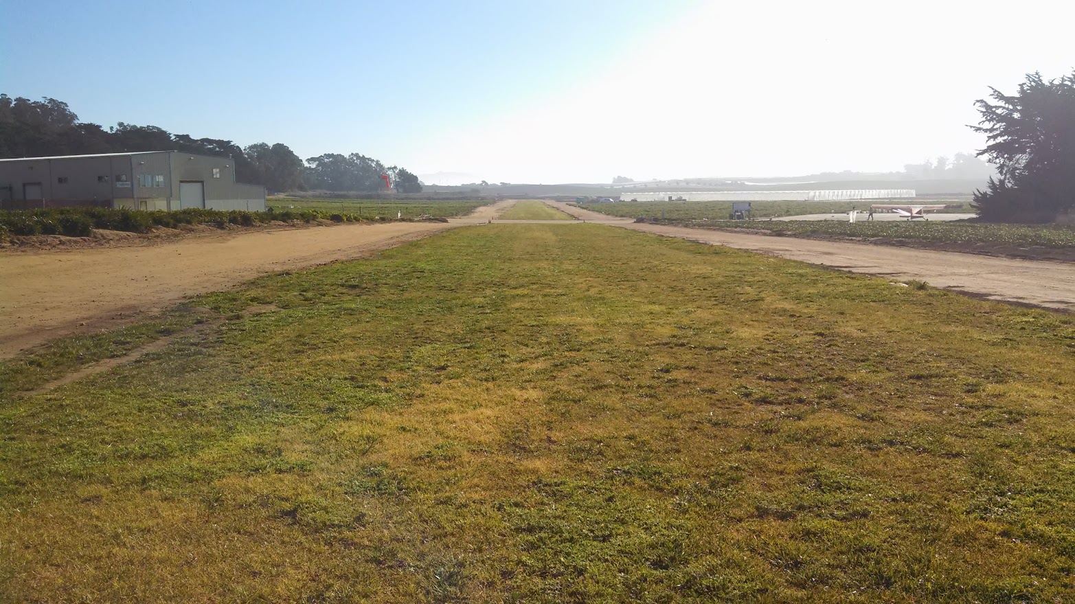
Sunday morning was clear and cold.  There was dew on everything.  I left the doors open on the plane in hopes that the windshield wouldn’t fog up.  Well, the windshield was complete fogged up and covered in dew.  Even though it was very cool out I was still nervous about taking off with all my camp gear aboard.  I stowed my chair, my clothes, sleeping bag, and the wet tent I had folded up.  It felt like it weighed twice what it normally does.  I shifted it from the aft baggage to the cockpit baggage compartment just in case. Even with the towels I brought I still couldn’t satisfactorily get all the dew and fog off the windshield.  I went ahead and fired the Redbird up anyway hoping that the wind from the prop would clear everything out.

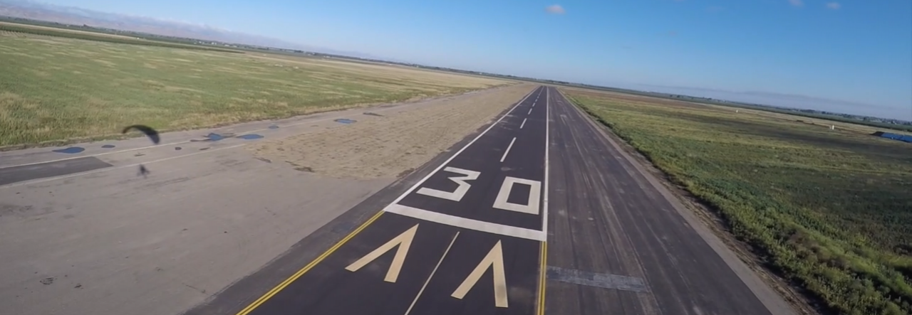
I let the engine run for about 10 minutes letting the oil heat up.  I then taxied up the hill to the run up area.  The increased power I had to use to taxi did a pretty good job of clearing off the dew and by the time I had finished my run up most of the fog was gone from the inside of the windshield.   I lined up, called my departure on the radio and began my takeoff run.  She bounced around in the grass a little but otherwise the runway felt really smooth.  I felt the tail sluggishly come up and knew I was almost at flying speed.  It would just take a few seconds longer than normal at this altitude.  I quickly glanced at my airspeed indicator as a double check for flying speed.  It registered ZERO MPH at first and then bounced up a little to 45 MPH.  That’s not flying speed.  Be that as it may the plane rose lazily into the air.  I relaxed the stick a little to stay in ground effect for a couple seconds to let the plane pick up speed.  When she had the speed she liked she began climbing even without me moving the stick.  The airspeed still only read about 55 MPH but my GPS ground speed read 75 MPH.   Figured I either had a bug or water in the pitot tube.

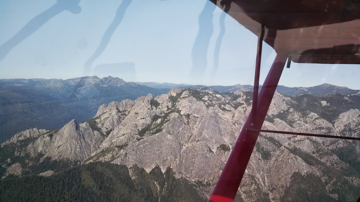
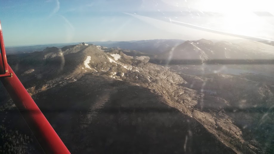
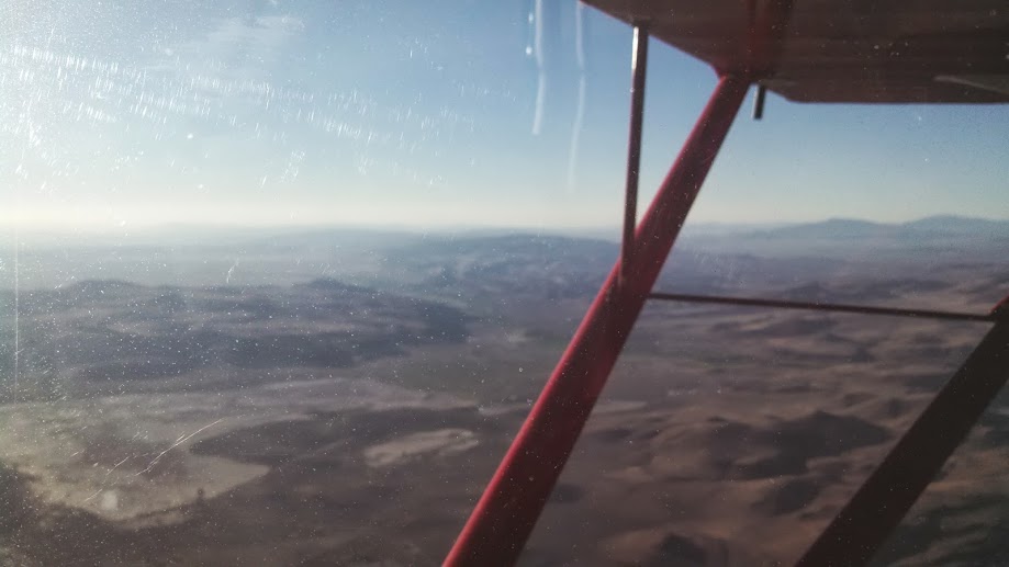
As I climbed out I kept to the right side of the canyon.  I made a wide, sweeping turn to the left and slowly came back over the field while keeping my right wing near the trees.  The plane was climbing good now and I slowly made my way up out of the canyon.  About the time I crested the canyon my ASI came alive and read correctly.  So I had water in my pitot tube and it had finally all evaporated.

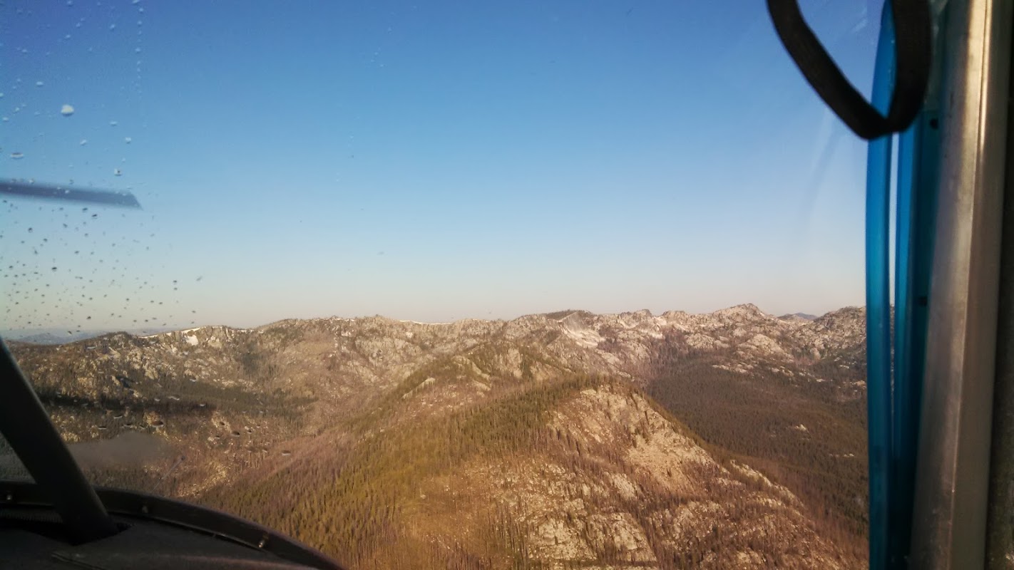
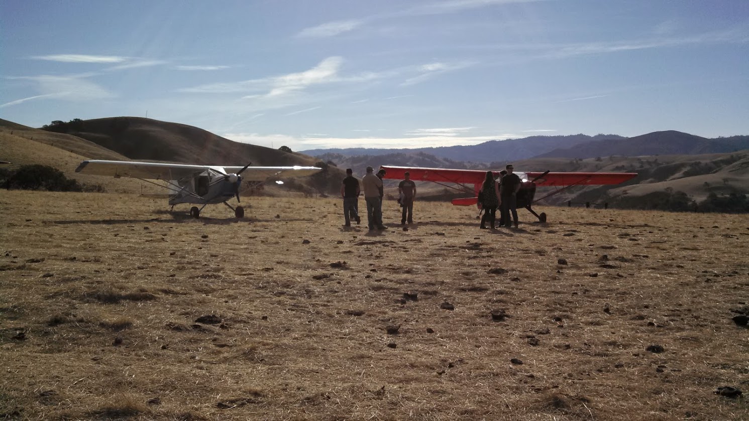
The canyon seemed dark but as I climbed out it was bright and sunny above.  I punched Cascade, ID (U70) and slowly turned on course to top off my tanks before heading to Bend, OR.

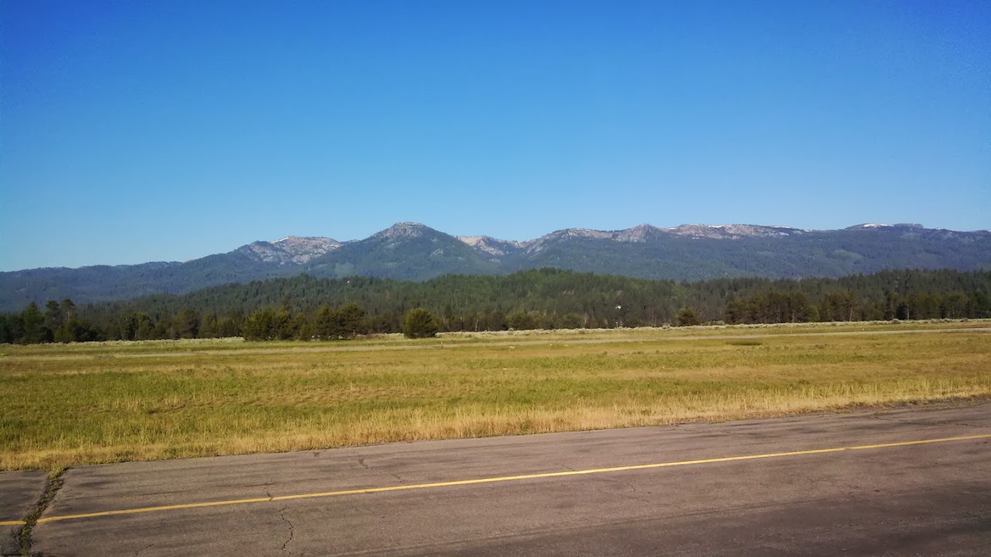
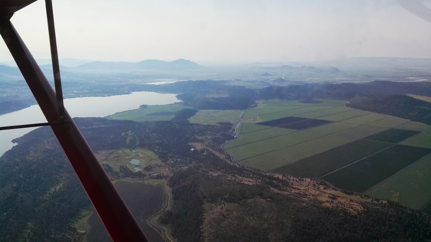
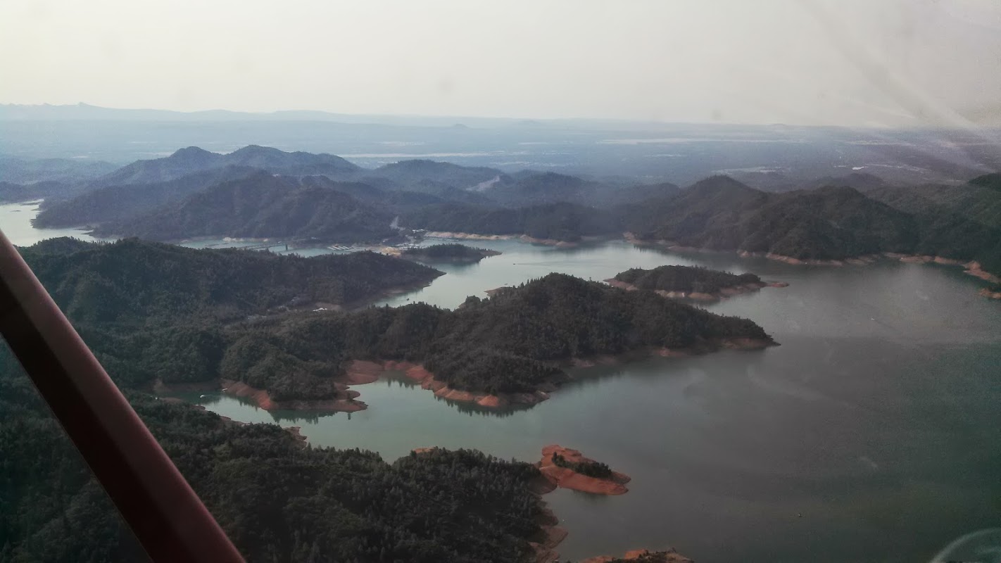
Cascade is in a beautiful valley next to Cascade lake.  I landed and the friendly FBO attendant topped me off.  I then took off and headed west toward Bend, Or (KBDN).

The flight to Bend was pretty and largely smooth.  It didn’t get bumpy until I was descending into the pattern.  The scenery was amazing.

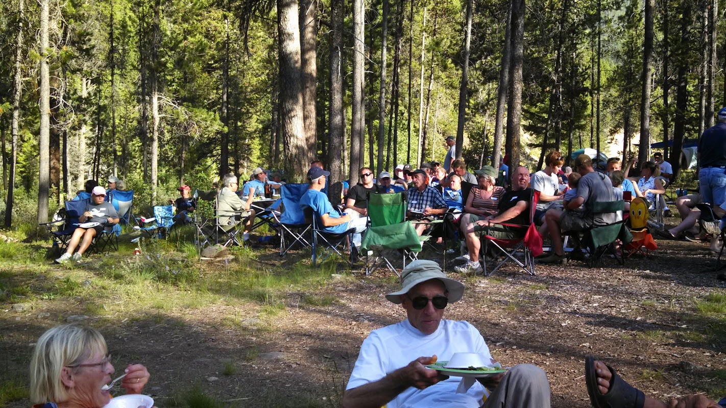
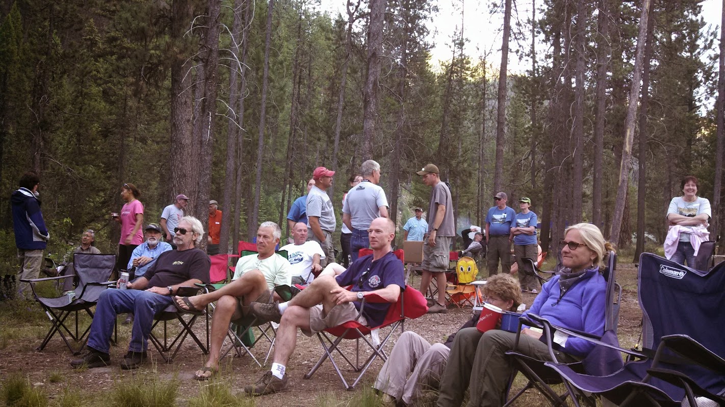
My friends picked me up at the airport and took me to their home so I could clean up.  We went into town and ejoyed The Bite of Bend.  It’s a festival where they close off the downtown streets and all the restaurants open up booths on the street.  I had some great red curry there from a Thai place.  It was about 103 and their kids were getting hot and cranky so we all headed back home to cool off and think about dinner.  We had a great pizza together and headed back home.  After the kids got to bed I finally got to talk to my friends.  It was great to catch up.  Again, these were people I knew from the Internet but had never met in real life.  I can’t wait to see them again some time. They are great people!  So great in fact that they got up at 5:30 to take me back to the airport!

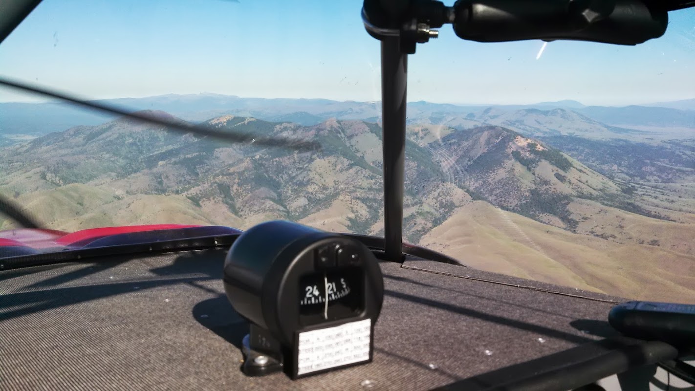
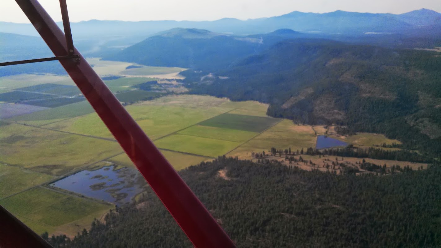
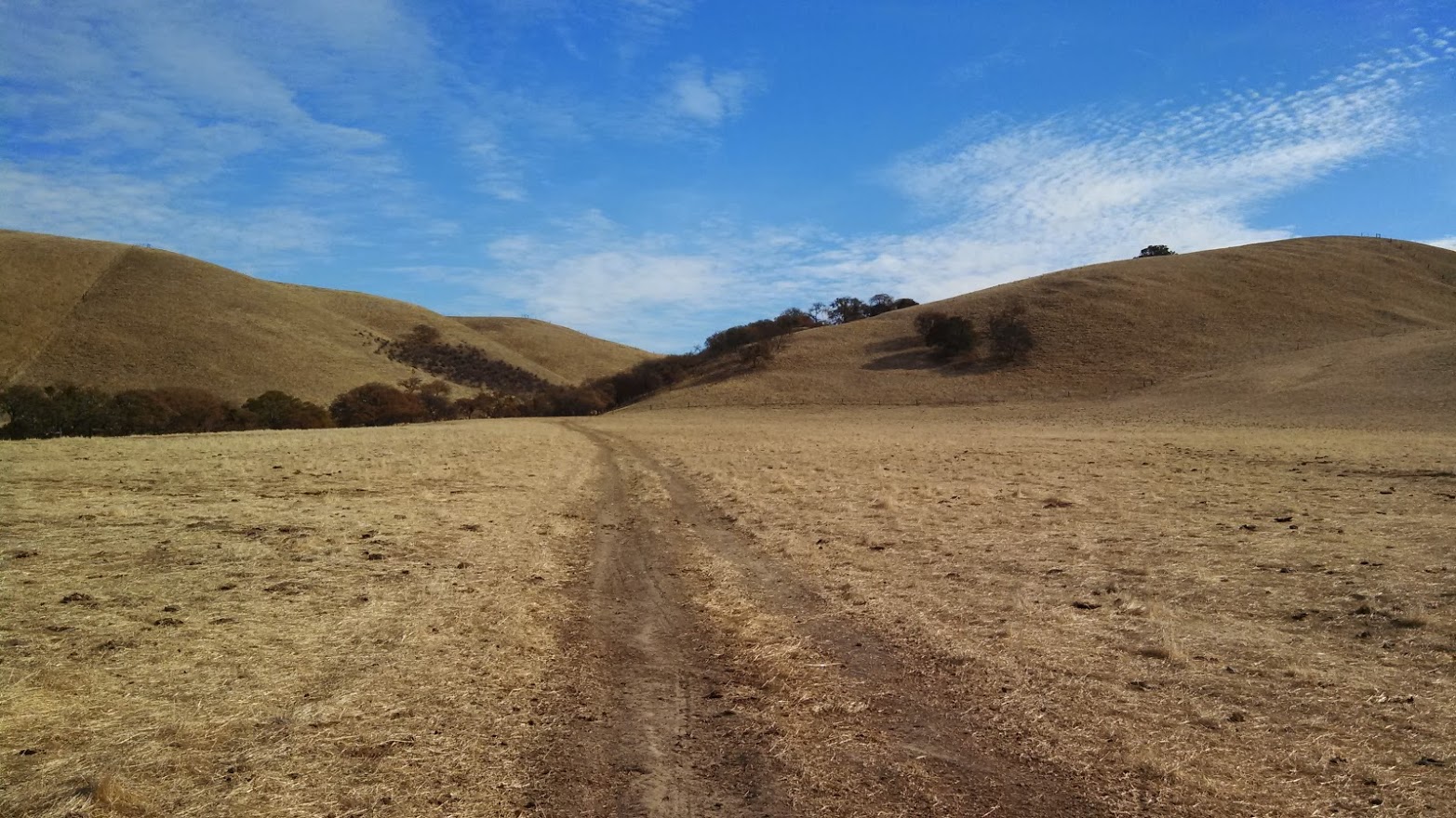
I had already tanked up when I landed in Bend so as soon as I had the plane ready I took off again and headed south.  This was the most turbulent part of the trip.  Even at 6am I was still getting some pretty significant bumps until I had reached Klammath Lake where it smoothed out finally.   I tried to enjoy the scenery but the homeward legs are always the longest legs of any trip.

One thing I noticed was that it was sever clear when I took off but as I headed south, a haze from the north started to follow and then over take me.  It still didn’t detract from the scenery.

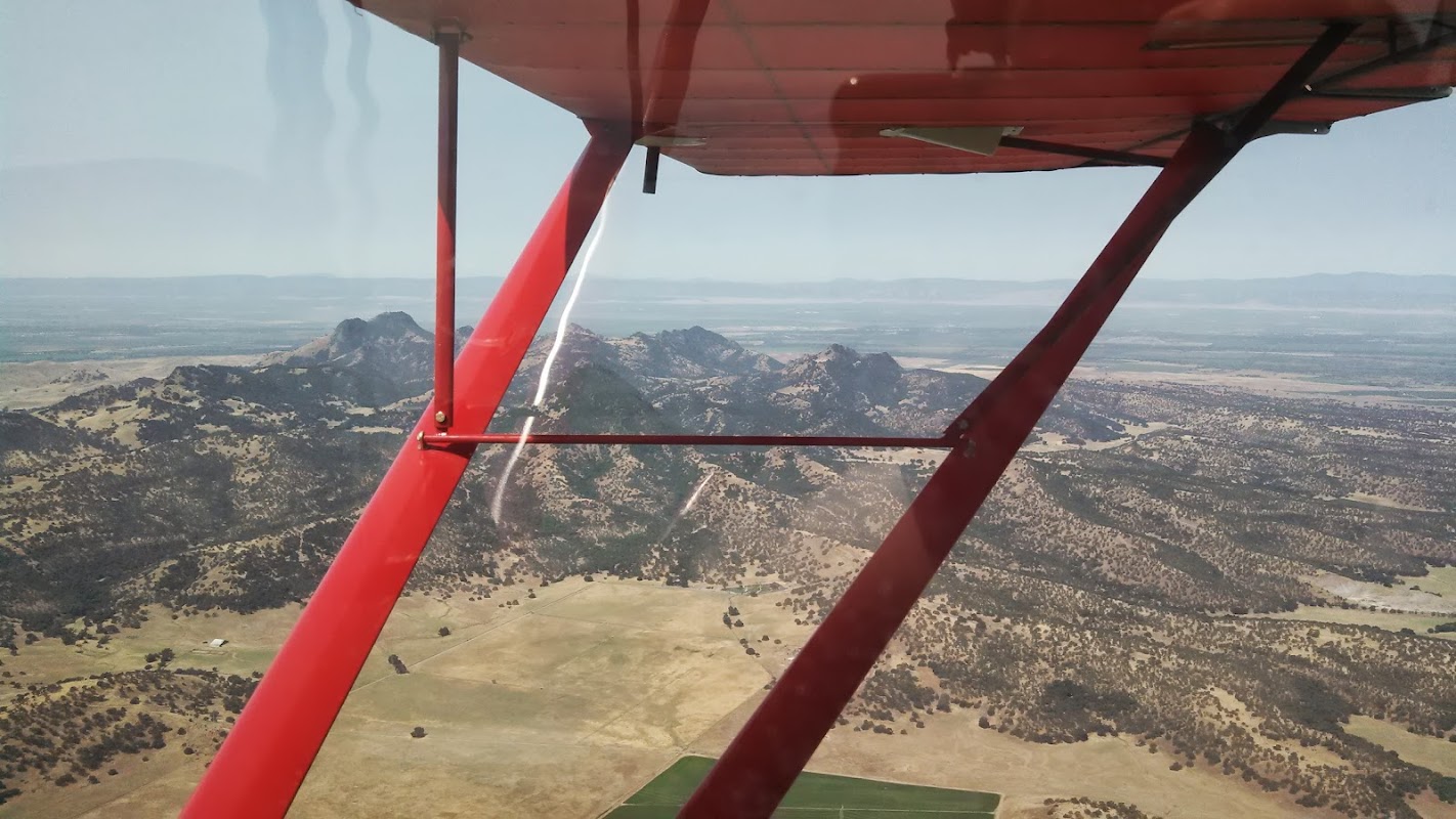
When Mt. Shasta came into view I knew I was almost home.

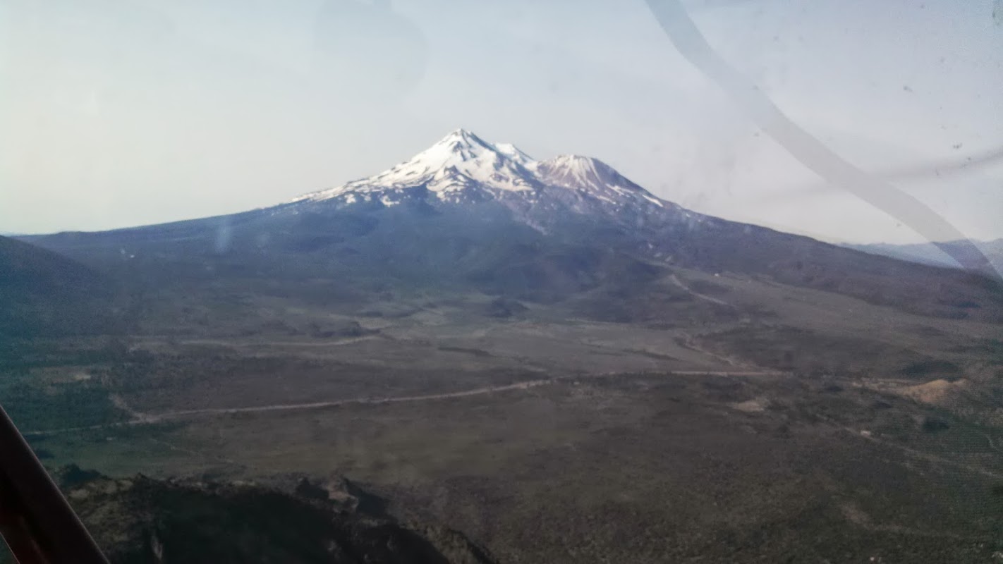
Along with Shastina, Mt. Shasta’s smaller neighbor.  Both are dormant volcanoes.

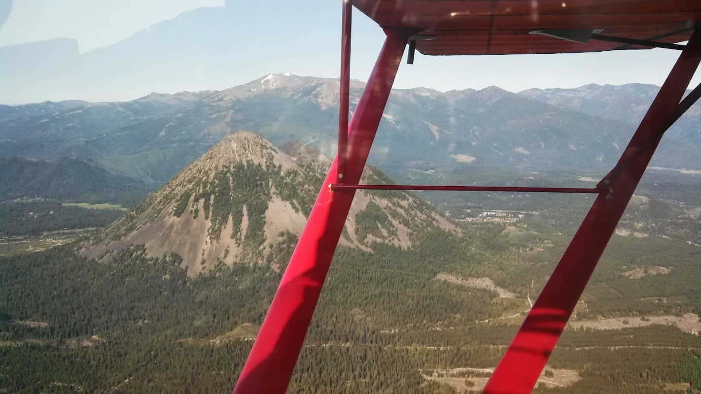
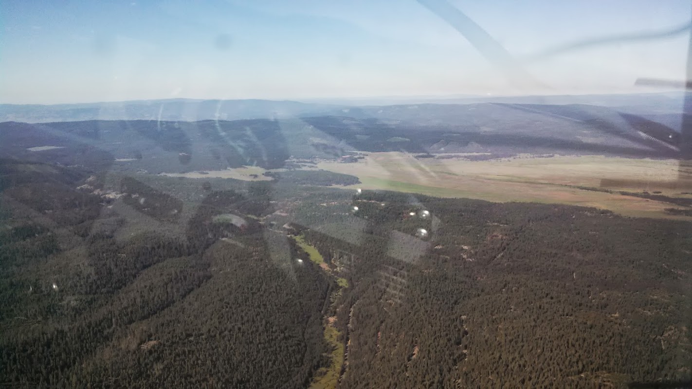
Once I passed Castle Crags, I could see my enroute fuel stop, Redding.

And there, just beyond Lake Shasta, lay my big valley…

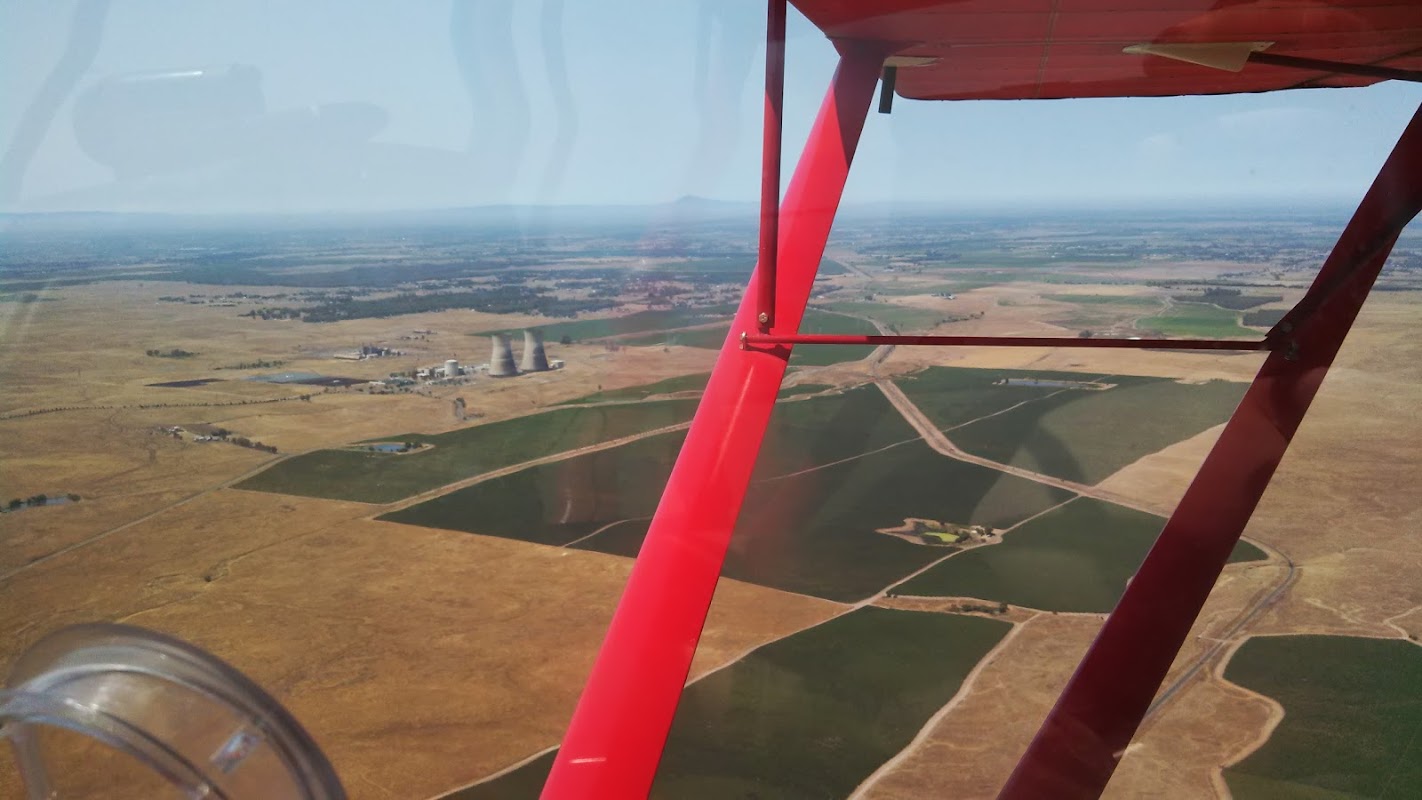
I topped my fuel tanks off quickly at Redding.  It was 9:00am and already getting pretty hot.  I was back in the air and southbound in 15 minutes.  I didn’t even need the GPS to get home from here.  Pretty easy. Just head southeast until you pass Sutter Buttes…

Keep heading south until you pass over Sacramento…

And then the old Rancho Seco nuclear power plant…

And 20 minutes later I was landing back at Oakdale!

This was definitely on of the funner long cross country trips I have been on with my plane.  I have flow to Oshkosh and Oklahoma but those were really long and tiring trips.  This was wasn’t that long and had GREAT people at every stop I made.  I logged about 14 hours, covered about 1500 miles of ground, and saw some of the most beautiful geography in the country.  It’s a trip I would recommend to anyone. But first I would recommend a good mountain check out, and brush up on your short and soft field procedures.

Fly safe.

My First Trip to Johnson Creek–Part 3

My first fill day at Johnson Creek had me waking up at 6:30am to the sound of an airplane taking off.  Since you are in such close proximity to the runway they take off practically right over your head.  Nothing like the supersonic cracks of a constant speed propeller waking you up in the morning!  The early bird was joined by an almost constant precession of airplanes taking off.  I decided to stay in my sleeping bag because it was COLD!  Hard to believe it would get up almost to 100 degress later in the day.

I enjoyed a nice leisurely breakfast of the provisions I had brought along.  Given the previous days’ events I decided to just hang around the campgrounds.  It was a beautiful place why go anywhere?  I spent the morning catching up with friends I have known for years via the Internet but never met in real life.  Later on we drove into town in one of the courtesy vans to have lunch.  The food in Yellow Pine was mediocre but the company was great!  Glenn Mathis and his wife Gwenn, and Tracy and Neil Salmi formerly of Rans.  I got some great flying tips from Tracy and Neil, both of whom know Rans airplanes like the back of their hands.

Saturday night was the big potluck.  There were probably about 80 people present and there was PLENTY of food.  Lots of leftovers.  The highlight of dinner was the home made ice cream  Apparently in years past they had run out but not this time.  There was enough ice cream for seconds and thirds and even the kids that were there got tired of eating ice cream.  After dinner a raffle was held.  The prizes included aircraft oil, tie down kits, fuel bags, and even a Hawaiian vacation and a ski trip.  What was kind of ironic was that the person who donated the Hawaiian vacation won the ski trip.  Can you say “rigged?” Smile

After the dinner and raffle there was even a band who played for an hour or so.  Yes, they hauled in their instruments and amplifiers and all by plane!  There was much revelry into the evening but I am not a night owl.  I walked among the various groups of campers visiting for a while.  Everyone was friendly and offered me a seat.  But my mind was already on the next morning’s departure so I didn’t stay up too late.  I headed back to my tent and fell off asleep pretty quickly.

My First Trip to Johnson Creek–Part 2

After enduring a sleepless night on a scratchy couch in an airport shack in Emmett, ID I was finally on my way to Johnson Creek.  The air was cool and still and as long as my vise grips held, I was certain I’d be sleeping in my tent this night.  I spoke to some locals in Nampa the day before and was told that the way they always flew into Johnson Creek was to head direct toward Warm Lake or Landmark (a USFS air strip) and then fly up the drainage (canyon) to Johnson Creek and that way I would be able to fly a fairly normal pattern, though it would be a tight pattern.

That’s pretty much how it went down.  Again, I had the sun in my eyes so it was difficult to see down in the drainages.  I found Warm Lake up on the ridge just south of Johnson Creek and adjacent to Landmark.  I crossed the ridge and then started to descend into the drainage.  It was still smooth as glass.  Soon Johnson Creek came into view and I was still a little high so I chopped the power so I could really get down into the bottom of the drainage. 

A friend had sent me an email the night before with some last minute instructions on landing at Johnson Creek which I kept reviewing in my head.  I knew I needed to get closer to the right side of the drainage, to stick my wing in the trees as it were.  The problem was it was all in darkness on that side of the canyon.  The sun was blinding me to what was there.  Soon I was in the shadow of the side of the canyon and I could see better.

The radio was letting me see what I couldn’t hear.  Plane after plane was departing JC.  Everyone was on their breakfast run.   I entered the downwind and announce my intention to land.  Two planes radioed back that they were rolling and would try to stay out of my way.  (Yeah!  My antenna really worked!)  I rolled around onto final into what would be an overshoot in a normal pattern, but at JC it’s SOP.  And here is where I ignored the advice given me.  I came in low over the trees at the north end of the strip and as soon as I had cleared them I chopped the power.  I touched down maybe 200 feet beyond the end of the runway and stopped maybe 300 feet later.  I had really underestimated how quickly the plane would slow down on the runway!  I added power and started taxiing up hill.  Then I came to my senses and thought, get off the runway stupid!  So I moved off to the side and continued my uphill slog.  Luckily there were no more planes either landing or taking off so I didn’t inconvenience anyone.

I pulled up next to a spot that had a tent but no airplane.  I tried to estimate about how much room an airplane would need and pulled in.  I went through my after landing checklist and then shut the engine down.  I sat in the cockpit for a few minutes with the doors open.  I took in the tree covered canyon wall in front of me, listened to the sound of Johnson Creek rushing by, the few birds that were in the area, and just let the adrenalin slowly drain from my body.  I wasn’t afraid on the approach, I was very alert, and now I was very elated!  I made it!

First order of business was to set up camp.  Once I had the plane positioned where I wanted it I set up my tent and pulled all my camping junk out of the plane.  Tent, check.  Chair, check.  Food, check.  Way too heavy tie-downs, check.  The plane was now empty, camp was set up.  Now I had two choices, fly out for breakfast or take a shower.  Since I was pretty sweaty and grungy from sleeping in the pilot shack in Emmett I decided to take the shower.  That turned out to be a VERY good decision.

Since everyone was either gone or relaxing (it was 0900 by this time) I located the showers and took a nice hot shower.  Afterwards I was out talking to some of the folks from NorCal when I saw everyone heading toward the north end of the field.  Some were jogging, some were running, some were walking.  I thought it must be some ritual that I didn’t know about.  I put my shower kit back in my tent and hung up my wet towel, no mind you, the required walking across the field.  I still didn’t notice what had happened.  Then I saw the wife of one of the NorCal guys and walked over to say hello.  That’s when I noticed. 

At the north end of the field two planes lay in a crumpled heap.  My first urge was to run down there to see if they needed any help.  But my first glance around told me that they didn’t.  With all the people swarming around they had more help than they needed.  I walked over to where the friends wife was sitting in the shade of a Maule’s wing and asked her what had happened.

The information came in slowly from different people but what had happened was there was another influx of airplanes coming in to land.  One was a Piper TriPacer, the other a Piper Arrow, not a Baron as reported in the news.  The TriPacer was struck from behind by the Arrow.  Neither one saw the other.  They collided between 40 and 60 feet in the air and fell in a heap.  The two men in the TriPacer sustained relatively minor injuries.  The man in the Arrow sustained more serious injuries and had to be LifeFlighted out by helicopter.  There was one passenger aboard the Arrow who did not survive the crash; the pilot’s 20 month old son.  He died shortly after being extracted from the wreckage.

Shortly after the crash we received word that Johnson Creek airport had been closed until further notice.  All the planes that had gone out for breakfast would not be allowed to return until the FAA reopened the airport.  This meant that 60 airplanes or so would have to find other placed to go in the mean time.  The day dragged by slowly.  I didn’t have much of an appetite and the only subject of conversation that day was the crash.  That didn’t help my appetite much either.

Finally at 7pm they reopened the airport and there was a rush of planes coming back.  Several times I thought we would have a repeat accident.  Maybe it was just my visual perspective.  Happily, there were no further incidents and everyone landed safely.  Including a couple of internet friends that I knew through my Rans affiliations.  Even though the airport was now a little more lively now that everyone had returned, the wreckage stood down at the far north end of the field as a somber reminder of the day’s events.

My First Trip to Johnson Creek Airport (3U2)–Part 1

For those who have never heard of Johnson Creek Airport it is considered the gateway to mountain flying in Idaho.  It is like the Ritz Carlton for back country aviators.  It is a beautifully manicured 3400 foot long, 150 feet wide grass runway near Yellow Pine, Idaho.  Never heard of Yellow Pine?  I’m not surprised, it’s a long way from anywhere.

My day started at 0430 Pacific Time.  I had already packed my camping equipment in the plane and fueled up.  All I needed to do was throw my suitcase in the plane, update my weather briefing, and go.  I actually should have gotten an earlier start because as I was climbing out over the Sierras the sun was coming up.  This made the peaks particularly difficult to see as I was climbing almost directly into the sun.  As I leveled off at 9,500 MSL over Lake Tahoe I turned toward Lovelock, Nevada I at least got to turn to where the sun was hidden by a tube in my cockpit.

About two hours after I departed Oakdale I was landing at Derby Field, Lovelock, NV.  There isn’t much there other than an old MIG and a fuel pump.  I topped off and continued on as fast as I could.


The scenery pretty much stayed the same for the next two hours.  High desert punctuated by low mountains all the way up to the Boise, ID area.

I stopped in Nampa, ID for fuel.  It took me forever to figure out how the fuel pumps worked there.  How many different places can they think to hide a fuel pump switch?  I topped off my tanks and taxied out to depart.  It was hot and the density altitude was pretty high so it was a long takeoff run followed by a listless climb out.  I felt some odd turbulence as I was climbing out but didn’t think much of it.  I was also unable to clearly hear the AWOS (Automated Weather Observation System) at Nampa.  Oh well, continue climbing out and heading toward Cascade, ID to top off once again before heading into Johnson Creek.

As I got closer to the mountains it started getting really bumpy.  I looked at my phone to see what time it was; 1:15pm.  Dang.  I really should have started earlier.  As the bumps got worse the advice given me about Johnson Creek kept ringing in my head, get it on the ground by 11am.  Double dang.  I elected to divert to Emmett, ID and wait out the heat.  I enjoyed a bumpy flight all the way into Emmett and made an uneventful landing.

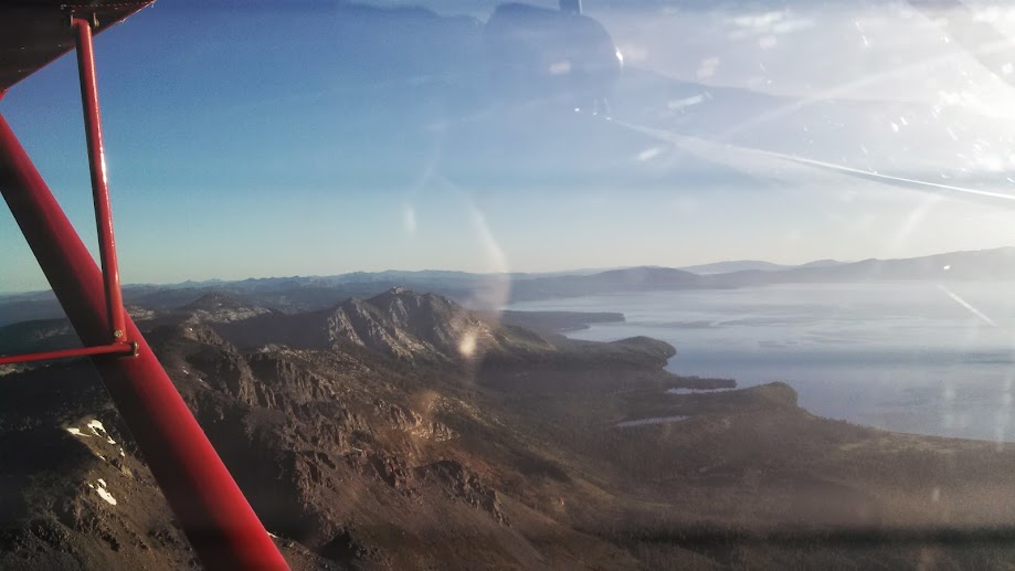
I still had plenty of fuel so didn’t bother topping off.  I elected to escape the 100+ degree heat in their local pilot’s lounge.  Pretty much a small shed with a couch, table and chairs, and most importantly, an air conditioner that could cool an entire house!

I turned on the air and after I cooled down decided to go get a snack out of the airplane.  As I walked back toward my airplane I immediately recognized what caused the unusual turbulence as I was departing Nampa.  My communications antenna was missing from the bottom of my airplane!  Triple dang it!

At this point I knew I really couldn’t continue to Johnson Creek without some way to communicate.  While it is completely legal to do so, it is not wise.  As long as the ring terminals on the antenna wires had not been torn off, I could gerry rig up a new antenna.  I decided to go into town and see what I could scrounge up.


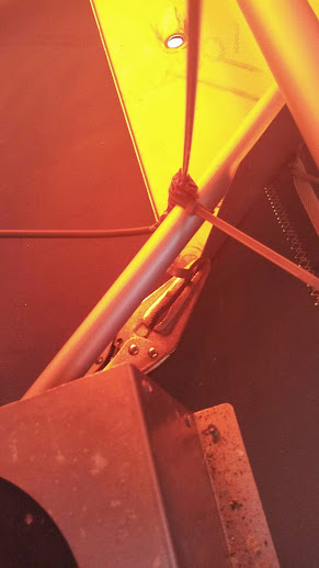
I borrowed the courtesy car and drove to their local True Value hardware store.  I bought a piece of brass welding rod, some duct tape (red to match my airplane), and an assortment of zip ties.  I drove back to the airport after stopping to buy a HUGE cold soda.  After I got back I pulled all my cargo out of the plane so I could get to where the antenna was mounted.  As I had suspected the ring terminals were still intact on the wire ends.  I slipped the center conductor ring terminal over the welding rod and zip tied it in place near the bottom of my new “antenna”.  I then wrapped the entire lower end of the rod in duct tape to insulate it from the ground plane.  A ground plane is a piece of metal that all antennas need to operate properly.  I then zip tied the base of the antenna so that the bottom of the duct tape wrapped antenna was touching the ground plane.  I then used some vise grips to attach the antenna ground wire to the ground plane.

But what I didn’t know was if it really worked.  Luckily there was also a radio scanner in the pilot’s “lounge.”  It was set to scan about 10 frequencies.  A row of red lights would flash in sequence to show which frequency was being scanned.  But I would have to wait until it got darker to see the lights.  I whiled away the hours by having dinner, thinking, and chatting online with an Internet friend who is learning to fly.  It was finally dark enough that I could see the red lights flash when I propped the scanner up in the window of the pilot shack.  I powered up the plane and pressed the push to talk button and viola!  The red lights stopped scanning and one light stayed lit until I released the PTT button!  Then I had a thought, “were my radio transmissions going to be understandable?”  To test that I downloaded a voice recorder app for my smart phone and left it recording next to the scanner.  I went out to plane and transmitted “testing 1-2, testing.”  When I replayed the recording I was perfectly understandable.  My MacGuyver fix worked!

Being a cheap skate I decided to just sleep in the pilot’s lounge that night.  I wish I hadn’t I only got 2 hours of sleep.  But that didn’t matter.  I awoke at first light the next day and was airborne before the sun came up on my final leg to Johnson Creek!

Stay tuned for Part 2!

Worst Cross Country Ever

Not long after becoming a private pilot I decided to go on a fly-out with a group from our airport.  The group was full of seasoned aviators and a couple of cubs; myself and my buddy Bob.  The plan was to fly out from Oakdale down to Laughlin, NV.   The day of the flyout arrived but we had a high overcast and some light rain.  I wasn’t too thrilled about flying so far in these conditions but the more seasoned aviators assured me everything would be fine.  These systems come in from the north and generally don’t extend that far south.  That sounded reasonable to my inexperienced ears so the whole gaggle departed Oakdale to the south.

We got as far as Visalia and then it started raining pretty good.  We decided to stop for lunch and see if the rain would stop.  We called the local Holiday Inn which sent a shuttle to take us over to their restaurant.  We had a great lunch and were in good spirits all around.  We got back to the airport and an hour later the rain stopped.  We all topped off our tanks and were about to head south.  However, one of the most seasoned aviators said that he wasn’t comfortable pushing on in this weather.  He said he was going to be a chicken and head back home.  We bid him goodbye and he headed north while we all headed south.

As we headed south we kept having to climb to get over broken cloud layers.  Soon we had climbed above the overcast and were in bright sunny skies.  However, we were VFR on top.  But the sun seemed so bright and cheery after the clouds and rain below us we felt that the worst was behind us.

Our trusty 172M was purring like a kitten and winging us southeastward over Mohave.  By now we were a long, loose formation.  We had lost site of the 182 in the lead, and the 172 had lost site of us.  The PA-12 was still somewhere below us under the cloud deck.  We began to get concerned because the solid cloud layer was showing no signs of breaking up.  Our seasoned aviator had assured us it would break up soon.  It wasn’t.

The sun was now getting lower in the sky, just above the cloud layer by a few inches and we had finally arrived above Laughlin according to our GPS and our VORs.   We were ecstatic, there was a small hole in the clouds and we could just make out the airport and the hole was just big enough to circle down through.  The 182 and I were orbiting the hole and letting the trail guy in the 170 know that it was there.  He was still 25 miles out and begged us not to leave him up there alone.  We told him we’d circle the hole until he got there.  Then the hole closed up solid.

We asked the 170 where he was… he didn’t know.  So there we were, circling above an airport we couldn’t get to, waiting for a guy who didn’t know where he was, the needles on the fuel gauges were bouncing near empty, and the sun was setting.  The next 5 minutes passed intolerably slowly.  Finally the radio crackles with the sound of the guy in the 170.  “Hey guys!  I’m over the airport I’ll see you on the ground!”

Airport?!  What airport?!

We asked him what airport he was at because we couldn’t get to Laughlin.  No answer.  We were just evaluating our options when he comes back on the radio, “Oh, guess what guys, I’m in Kingman!  Not Laughlin!”  Bob and I looked at each other and then Bob punched Kingman into the GPS.  The 182 radioed that he was flying direct to Kingman.  We answered that we were right behind him.  The 170 radioed back that the sky was clear over Kingman.  We were so relieved!

However, we were about 15 miles south of Kingman and we were still over the cloud layer.  I told Bob we’re going to have to descend through it.  We lined up with the valley heading due north toward the airport and I got on the gauges.  I told him to call the ground as soon as he saw it.  It was the longest 10 seconds of my life. But that about how long I counted in my head before Bob said he had the ground.  I briefly looked away from the instruments to confirm we really did have the ground, we did.

As I turned onto downwind for Kingman the runway lights came on.  The fuel gauge needles were no longer bouncing, they were pegged on E.  I made an unremarkable landing and taxied up to the tie down where the 182 had just finished taking on fuel.  The fuel truck filled me up after I had parked and tied down.  He gave me the receipt and didn’t say a word.  I looked at the number of gallons we took on and estimated we had approximately 20 minutes of fuel left in the tanks.  If that.  I was never so happy to see the end of a flight.

Ironic twist to the story.  Remember the most seasoned aviator that turned back?  That was a good call but… the very next day he was involved in a classic highwing/lowing landing accident.  His 175 was totaled when  Piper Cherokee landed on top of him. Luckily no one was injured but both planes were a complete loss.